

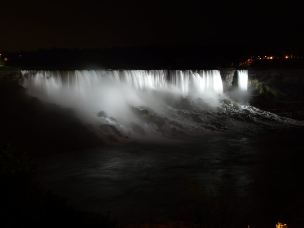
I peer over the edge of the sheer rock face as a cool metal railing pushes against my stomach. 50 feet below me, cold blue water churns and rushes in swirling whirlpools and eddies. My eyes are drawn upwards to the source of the moving water: Niagara Falls. As impressive as the Falls are to look at, I prefer to enjoy them for a moment with my eyes closed. I attempt to separate the sounds: the dramatic roaring of water at the base of the Falls; the occasional crack of a breaking icicle; the low swish of water running over the rock’s edge; and the almost unnoticeable dripping of melting ice.
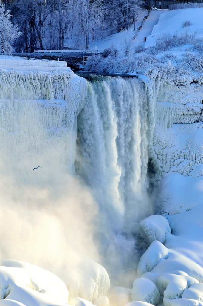
The clicking of a phone camera prompts me to open my eyes. I offer to take a photo for a family who are attempting a selfie with the waterfall. When I’m finished, they thank me, and I think of all the people who have enjoyed the waterfalls throughout the years. Before we had cellphones to document the moment. Before one side was deemed Canada and the other America. What did this place look like before the Lady of the Mist took visitors right up to its base? What did it look like from a handmade canoe? How did it look before it was enjoyed by humans, or any form of life?

To answer these questions we’d have to go back more than 440 million years! The continents that make up the world looked a lot different back then. The land that makes up Niagara was then on the edge of the continent of Laurentia (near Hamilton in this photo). Baltica, Avalonia and Laurentia collided and pushed up the ground forming a massive mountain range.
I’m not a mountain climber, so I probably wouldn’t have been standing on this spot 430 million years ago when the mountains were larger even than the present-day Himalayas. As the continents collided, the mountains created an inland sea to the west of the mountain chain, near present-day Niagara Falls. The inland sea was filled with a large pile of sediment that washed down the mountains through rivers. These sediments created the layers of rock that can now be seen in the Niagara Escarpment.
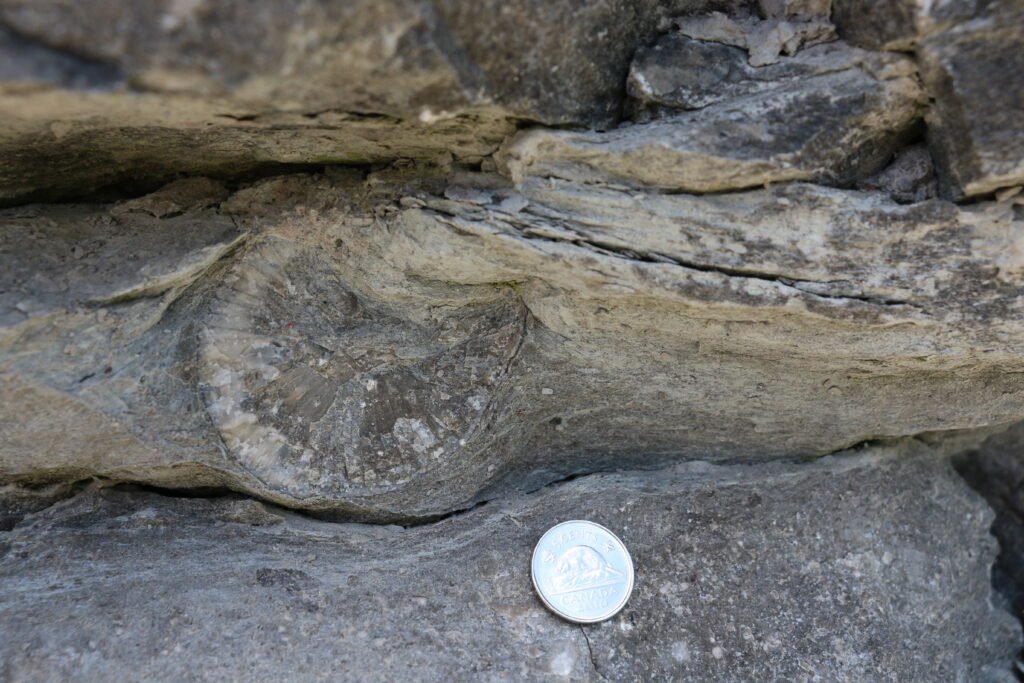
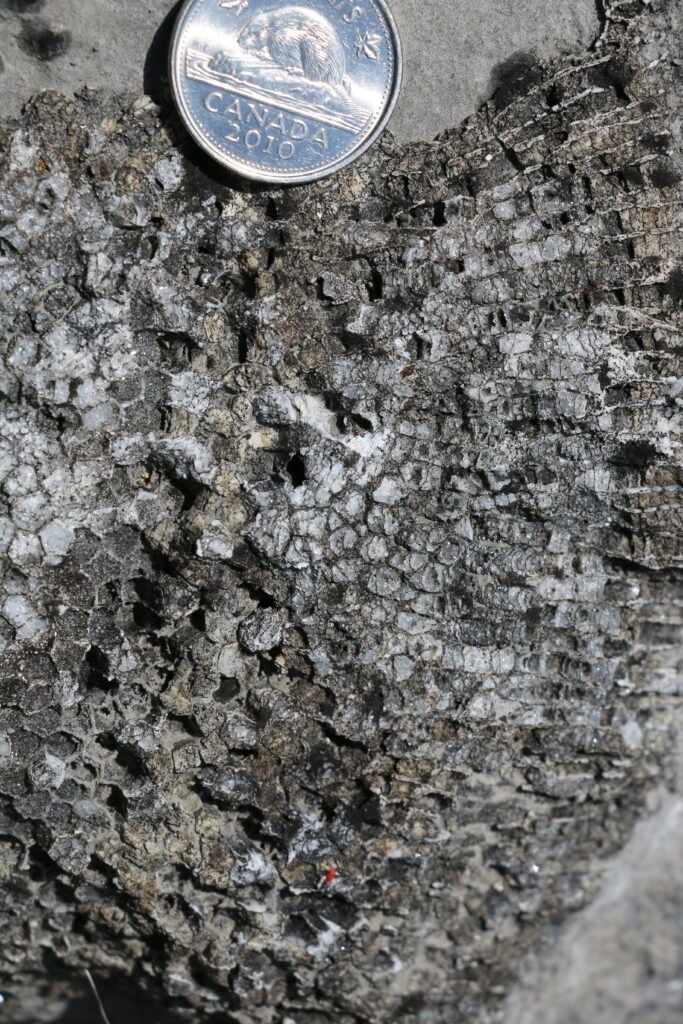
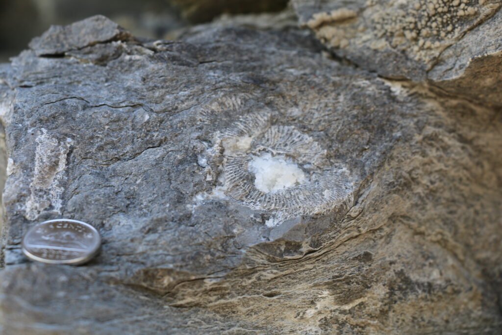
After 20 million years of active movement, the mountain building stopped and there was much less sediment being carried to the inland sea. This resulted in beautiful clean and clear water that was the perfect environment for coral reefs. If you look closely at the rocks around Niagara Falls, you might see the fossilized corals and sea life that lived around 420 million years ago when Niagara was a tropical paradise!


Over the following 400 million years, the continents continued moving until they reached their present day positions. During this time, the land around Niagara was exposed to the air. This means that no new rocks formed. But the land was not still as erosion from rivers and weathering slowly wore away at the mountains, leaving them little more than the big hills we see today.
The next biggest change to the surface occurred approximately 3 million years ago, when the Earth started to cool and glaciers covered much of North America. As these glaciers grew and shrunk, they scraped the soil and top layer of rocks, moving large chunks of rocks and leaving these rocks in different places as the glaciers melted.
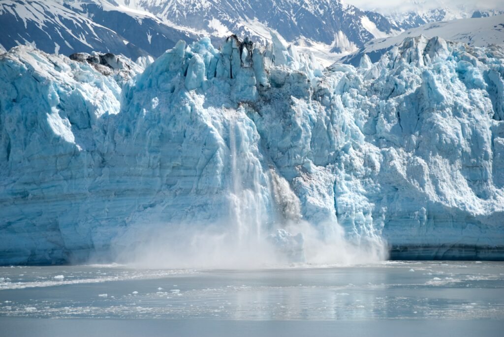
When the glaciers finally retreated from Canada, they exposed the two main bedrock units in Ontario. The first are the rocks of the older Canadian Shield. These rocks make up the beautiful cottage country that covers most of northern Ontario, with thousands of dark-water lakes and granite cliffs. The second are the younger Paleozoic rocks that include the eroded mountain range, the sediment from the inland sea, and fossils in limestones from the shallow sea.
But not all the rocks in the Paleozoic layer were created equal. Some rocks, like sandstone, are softer and erode quicker. Other rocks, like limestone and dolostone, are harder and don’t erode as quickly. The different rates of erosion created a cliff that we now call the Niagara Escarpment. The Escarpment in Ontario is a major geographic feature that extends for a remarkable 725 km from the Niagara River through Tobermory and Manitoulin Island.
As the glaciers melted, large volumes of water flowed from the melting ice through the Great Lakes, toward the St Lawrence River and eventually to the Atlantic Ocean. As the water flowed, many rivers combined to form the Niagara River.
The Niagara River then flowed over the newly created Niagara Escarpment, forming a waterfall that was the beginning of Niagara Falls. The Niagara Escarpment was, and still is, moving due to erosion. But the large volume of water in the falls meant that the Escarpment eroded much quicker at the waterfalls. Over the past 12,000 years, Niagara Falls has moved over 10 kilometres to the south and it is still moving!
This is why Niagara Falls looks the way it does today: impressive and large with grand cliffs following the river downstream from the Falls. We have continental drift, an old mountain range, and glaciers to thank for this. Niagara Falls is still moving and changing, and I think of all the people who will enjoy this waterfall in years to come. Maybe it will become even larger and more impressive, or maybe it will fade into a trickle that the birds will bathe in.
The sound of seagulls brings me back to the present. The wind changes and I feel a light spray from the Falls on my face. It’s gotten dark outside, so I tighten the scarf around my neck and begin to walk away, grateful for the journey of rock, water and ice that created this magnificent waterfall.
Want to learn more about the formation of Niagara Falls? Checkout our video: Niagara Escarpment: Its Fascinating Geological and Environmental History.

Veronica Klassen is the Manager of the Foundation’s blog – Beneath Your Feet: A Geoscience Blog. She studied Arts and Science at McMaster University with a minor in Earth Science and has a masters in Science Communication from Laurentian University. She is passionate about making science accessible and engaging to the public.